


Through its Perpetual Planet Initiative, Rolex is supporting Steve Boyes’ Great Spine of Africa series of expeditions, traversing thousands of kilometres of rivers that have never been scientifically documented
©National Geographic/Jen Guyton
This is the first successful Great Spine of Africa expedition to document and protect the river that feeds the Zambezi led by Rolex Perpetual Planet Initiative partner explorer Steve Boyes.
Over several years, the team plans to travel more than 40,000 km, equivalent to a journey around the planet. What it discovers will provide crucial information to protect the people and wildlife dependent on Africa’s great rivers.
Over 20 million people in southern Africa, and countless species of plants and animals, rely on the rushing waters of the Zambezi River. But much of its winding journey, from its marshy origins to the salt waters of the Indian Ocean, remains unknown to science. Learning more about its sources and unique ecosystems will help scientists and local communities to protect these areas and the Zambezi River into the future, building resilience against climate change.
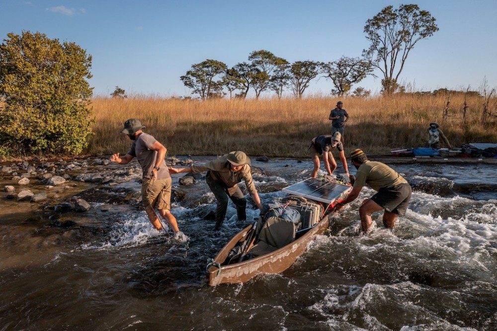
Lungwevungu expedition
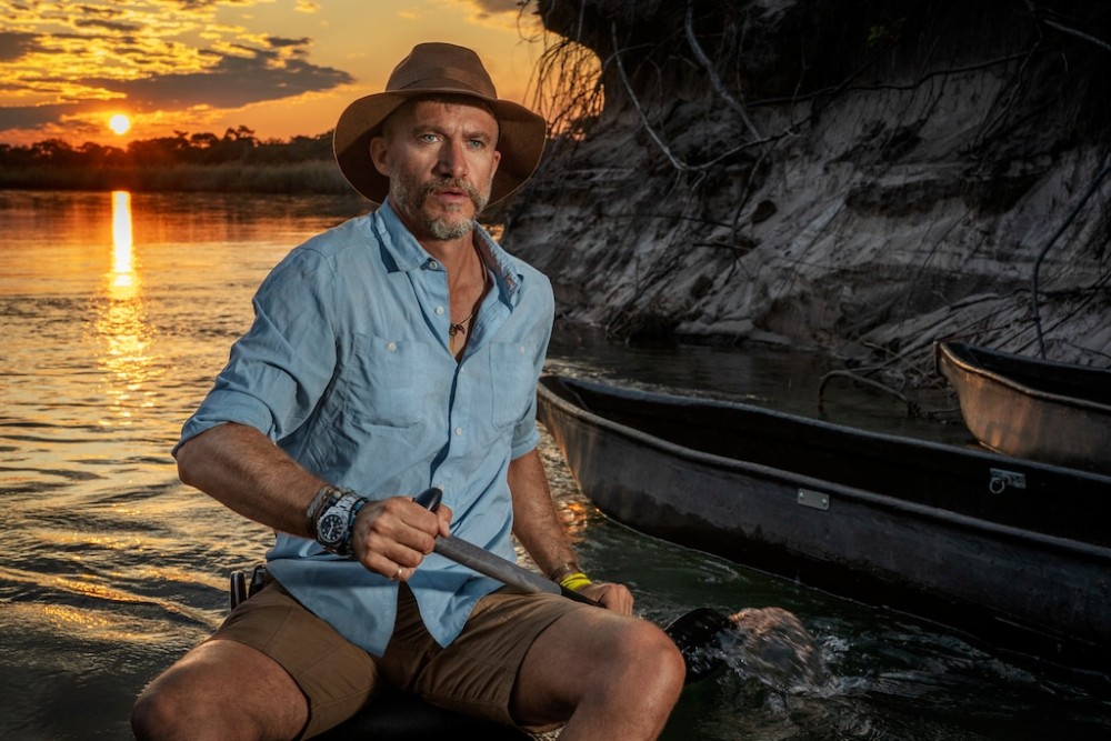
Renowned South African conservationist Steve Boyes and a team from the National Geographic Okavango Wilderness Project (NGOWP) were named Rolex National Geographic Explorer of the Year in 2019.
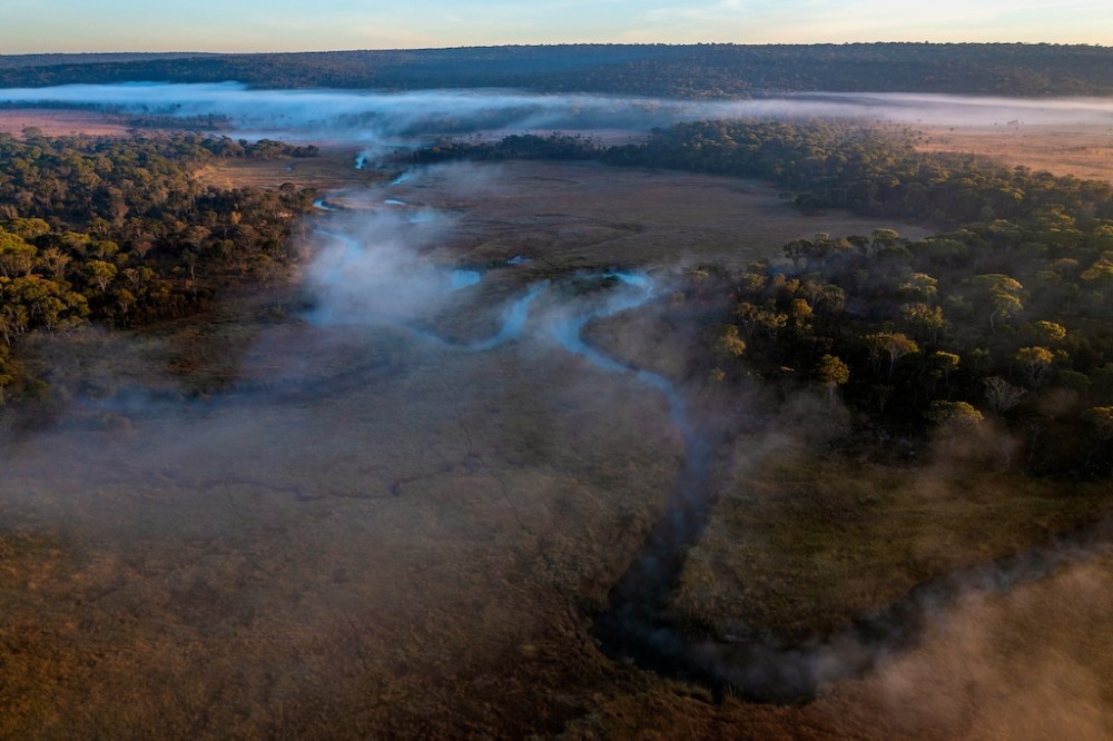
Boyes first ventured into the southeastern highlands of Angola with the NGOWP, working alongside community members and a multidisciplinary team. During that first expedition, they documented and discovered the importance of what they call the “Okavango-Zambezi Water Tower”, elevated areas of forest and peatlands with high rainfall.
©National Geographic/Jen Guyton
The peatlands act as sponges that feed the rivers, even during drier periods. These ecosystems may be critical as temperatures continue to rise and weather patterns change, but they are not easy terrains to navigate.
His latest initiative, the Great Spine of Africa series of expeditions, began in mid-2022 and builds upon this first NGOWP expedition, to develop these expeditions along the continent’s main rivers with the goal of better understanding and protecting Africa’s crucial waterways.
Baseline river health
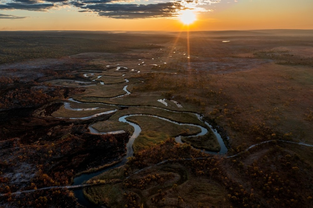
The first Great Spine of Africa expedition explored the remote Angolan highlands where the Lungwevungu River originates. Boyes and his team believe this tributary of the Zambezi could prove to be its source, an important factor when determining threats to the river.
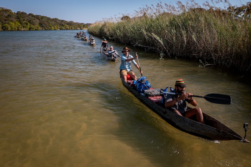
The team paddled down the Lungwevungu River in traditional dugout canoes known as mekoro, loaded with scientific equipment. By collecting extensive records and data points, the team hope to create a comprehensive baseline of the river’s health and ecosystems.
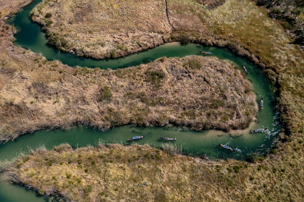
Along their 900 km route, the researchers recorded human settlements and wildlife sightings. They gathered environmental DNA samples from the water and examined fish and aquatic invertebrates. The water itself was analysed through systematic measurements of the river’s structure, flow and water quality. This exhaustive research is beginning to yield exciting results.
The team employed continuous surveying and detailed monitoring, documenting the habitats with photography and drone footage every 10 km. This rigorous baseline ensures that the work can be repeated at regular intervals in the future. Measuring change over time will be essential for the researchers to enact policy change with governments.
Also see: Rolex’s 25 years of Galápagos marine reserve protection